August 10, 2026
Barry Nolan
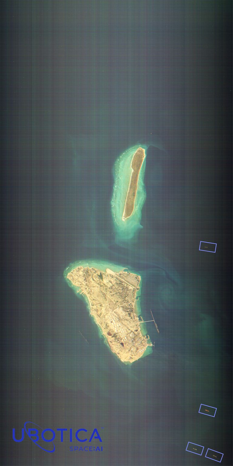
The future of maritime security, in one observation, over Kharg Island Four vessels, all are dark.
That is what the CogniSAT-6 satellite, built by Open Cosmos and flying Ubotica's onboard AI, saw in a single pass over Kharg Island, Iran's main crude oil terminal.Onboard Orbital:AI read the scene in orbit.
Four vessels detected in open water, located, measured and classified by size, including three at VLCC scale (aka supertankers). The detections reached the ground in minutes.
The full observation followed much later, as conventional Earth Observations always do.On the ground, our AI agents fused those detections with AIS, the signal every compliant vessel broadcasts to announce its identity, position and course. All four were dark: visible from orbit, silent on AIS. To be clear about what this is not. We do not publish live vessel positions in a conflict zone and we are not naming ships.
This is a retrospective observation, shared to show the method. Going dark is not, in itself, evidence of wrongdoing. But a crude terminal where four vessels are dark is exactly the kind of pattern that merits a deeper look.Most nations are responsible for a maritime zone many times larger than their land.
Beneath those waters run the cables and pipelines that carry the energy and data our economies depend on. No one can watch everywhere, all the time. And the threats do not sit still. Earth Observation should be the answer.
But today it works by brute force.
Point a satellite at the sea, capture imagery, send it to the ground, wait for humans to process it. By the time the answer comes back, the vessel that crossed your cable is hundreds of kilometres away. Excellent for analytics and planning. Not fit for purpose against a moving threat.
Orbital AI inverts that.
AI on the ground predicts where risk is rising and prioritises where to look. It then orchestrates the right sensor for the right observation: if a vessel needs watching at night, darkness will not stop a radar satellite, so it cues SAR first, then follows up with optical when the skies are clear and if additional observations are needed.
AI in orbit processes onboard and returns structured intelligence in minutes. AI agents on the ground fuse those detections with AIS, history and other sources to establish what each vessel is doing. Orbital AI learns. Every observation improves the next one.
So look again at Kharg Island. One satellite, one model, one pass, and four vessels that conventional tracking would have seen too late. Now run that loop continuously, across more satellites, more sensors and more models, each observation sharpening the next.
That is what Orbital AI unlocks. Predictive intelligence over the waters that matter most, getting better with every pass.
Less data. Less cost. More intelligence. More time to act.